A r t e r i o l e s
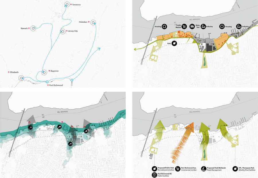
The waterfront remains the Port Richmond’s most valuable resource, and its preservation is crucial, both economically and ecologically. Our approach to reshaping the waterfront is not driven by land use, but by the contextual typology of pier structures aimed at extending the length of the shoreline. This strategy allows for an intervention sensitive to flooding and drainage issues, and for the restoration of ecological corridors that advance deep inland.
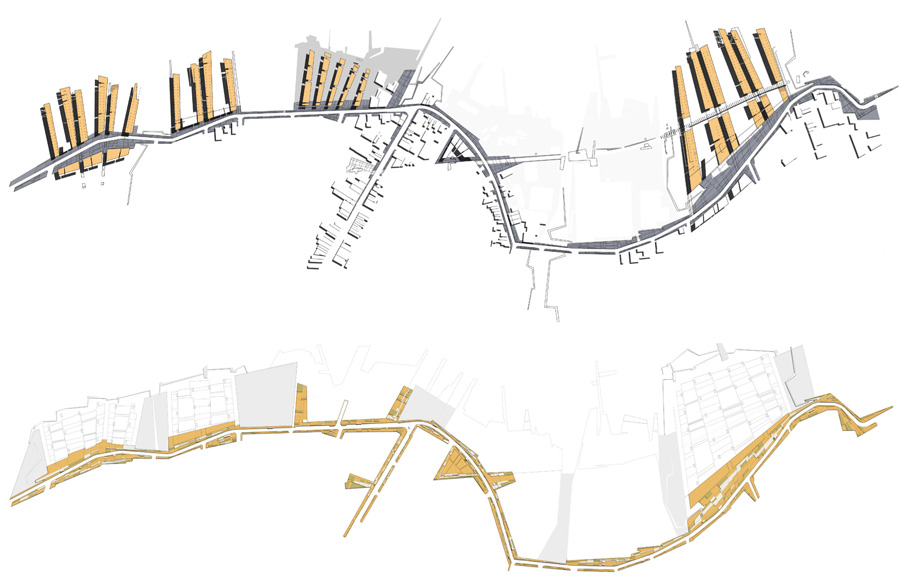
Along with the preservation of water‐dependent industry, our project proposes a more inclusive approach to inhabiting the waterfront, by introducing residential and commercial uses, critically linked through a public infrastructure armature. This intervention discourages the proliferation of non‐water specific industry, and generates a continuous public waterfront with pockets for future development.
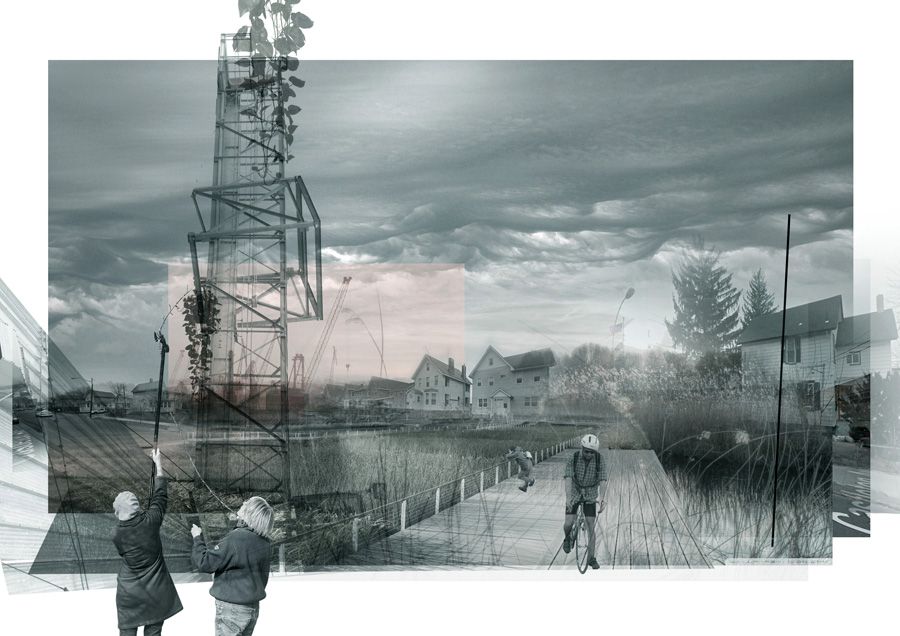
The public armature consists of a series of coordinated street improvements within localized enlargements of Richmond Terrace, linked through public transportation and new bicycle lanes, and incorporating a water taxi service and a community market. The parks along the armature not only maintain the continuity of the green corridors and ensure recurrent public waterfront access, but also act as buffer zones between industrial and mixed‐use areas.
scroll down to view
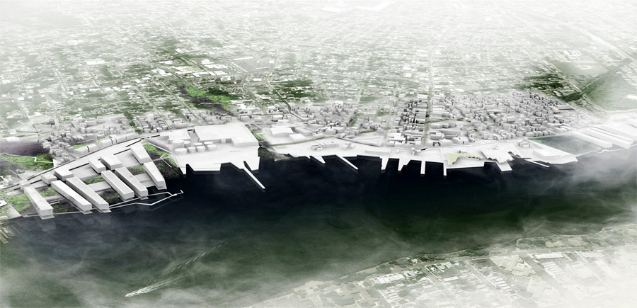 proposed waterfront. aerial view
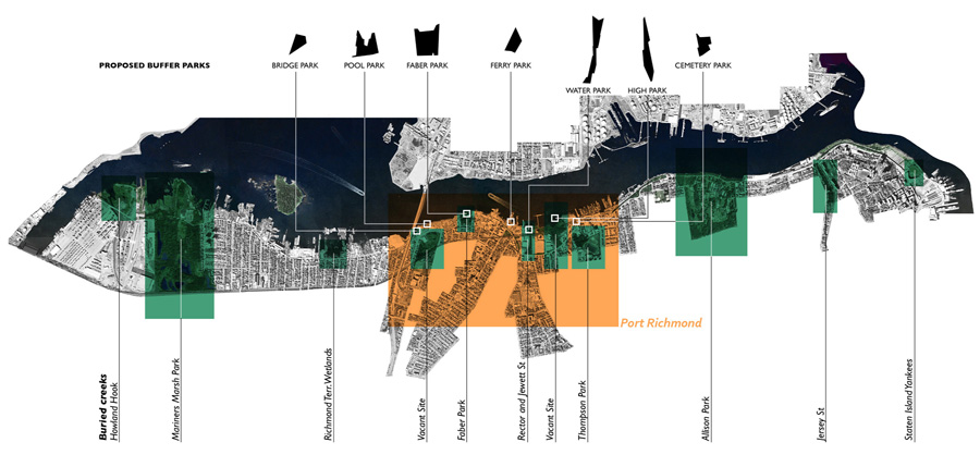
regional strategy. hydrological restoration of northern waterfront
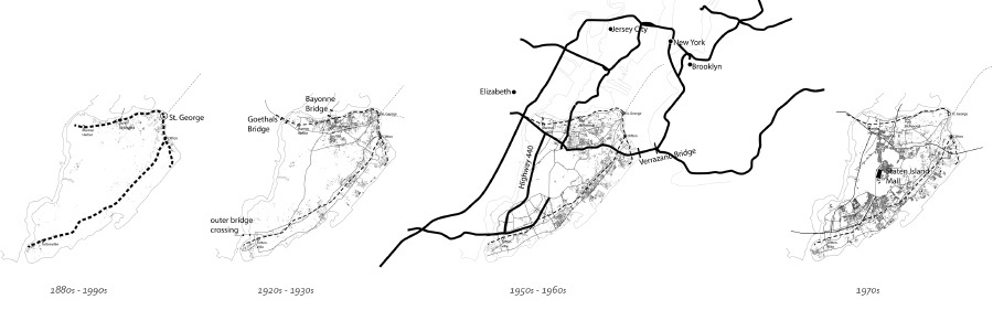 evolution of infrastructure

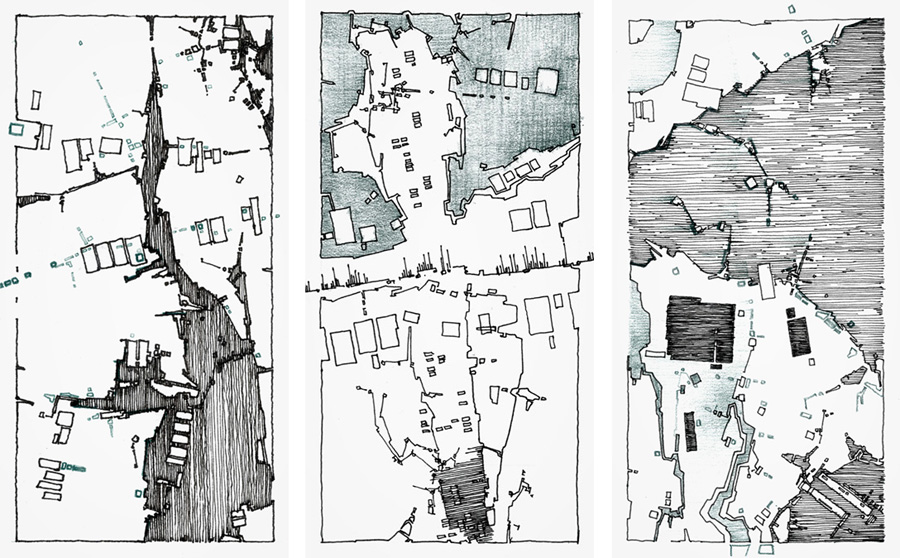
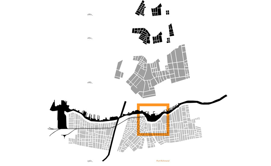 buried creeks and fabric over time
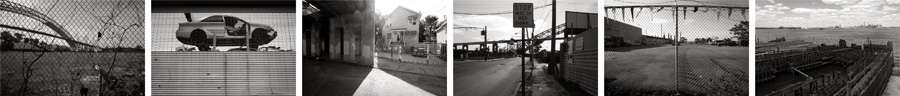
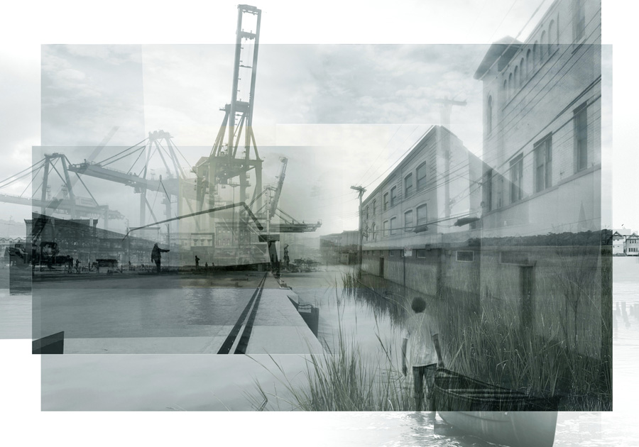
existing waterfront conditions
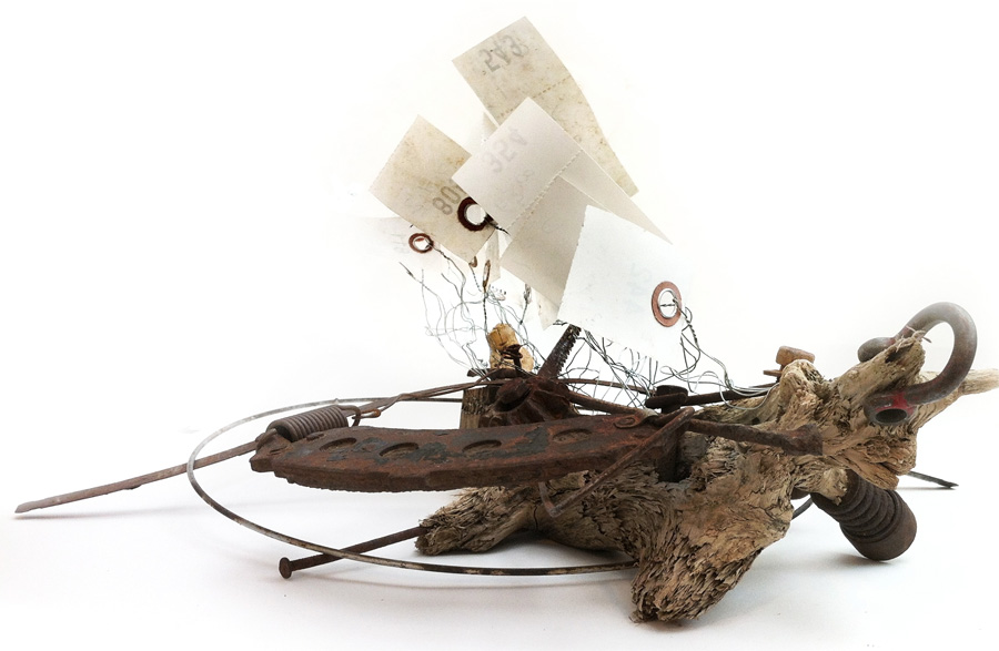 sailing homes for a mechanically mutilated shore. found objects

sailing homes for a mechanically mutilated shore. drawing
flood prevention studies
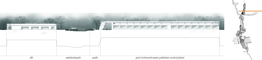
flood prevention. rector street creek restoration
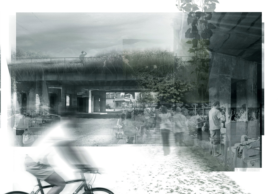 flood prevention. railway over port richmond avenue
flood prevention. richmond terrace avenue canal
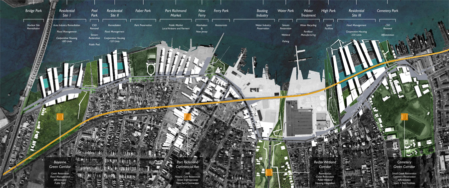
restored corridors. waterfront public parks as buffers between uses
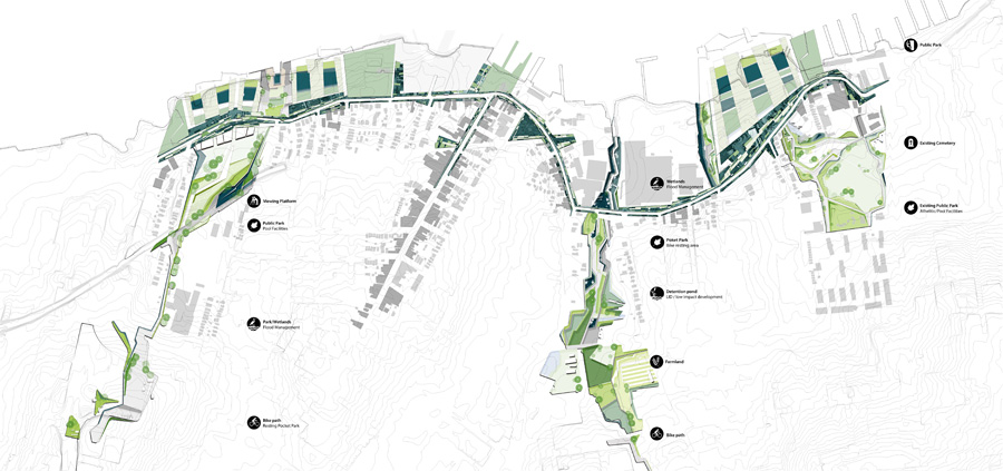
proposed plan
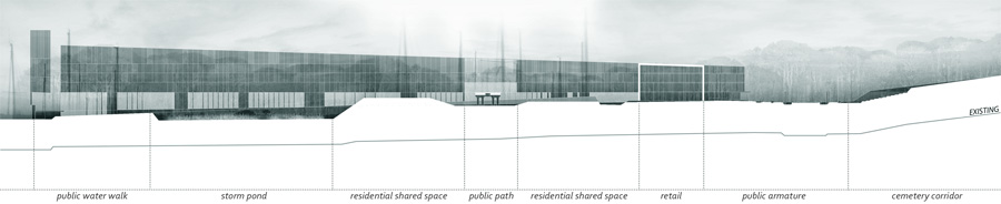
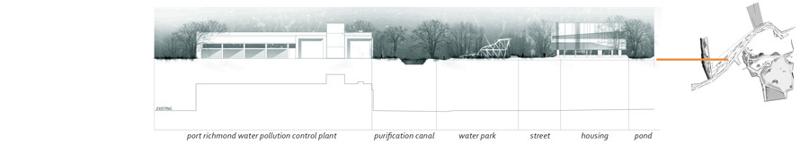
eastern housing site. section
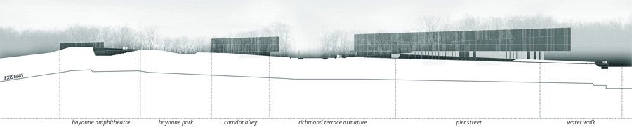
western housing site. section..
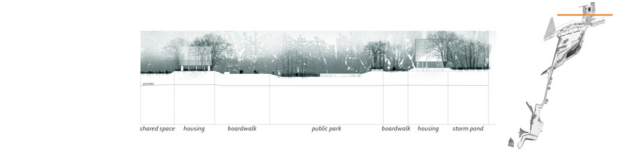
water park buffer. section
high park buffer. section
pool park buffer. section
armature and housing plans
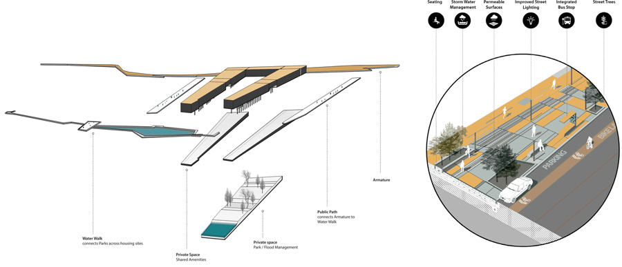
housing and armature details
Arterioles
5 Boroughs Studio
Staten Island, New York, NY. 2014
Graduate Work, Columbia University, Graduate School of Architecture, Planning and Preservation, New York. NY
Team: Julio Cedano, Hanquing Kuang, M. Razvan Voroneanu